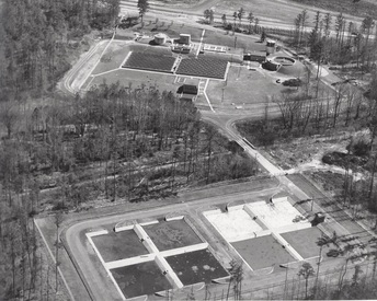
At its height, the sewage treatment plant covered an extensive area of the present day park. To the top of the picture is Sandy Creek Drive. One of the structures still standing (the gas tank) is just below the entrance road. Sandy Creek is in the center of the picture. Note that the creek, which once meandered through the park, has been completely straightened. The tanks at the bottom of the picture are now the wetlands mitigation area.
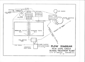
The flow diagram from 1957 shows the area of the present day park that can be seen from the parking lot. The Vacuator (circular tank at top left), the gas tank (top right) and the pump house (next to the Vacuator) are the only buildings still standing. At this time the aeration fields across the creek has not been constructed.
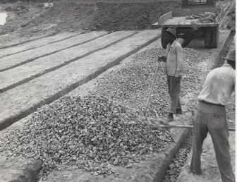
Before the City workforce was integrated, the New Hope Creek Sewage Treatment Plant (Sandy Creek) was staffed entirely by black workers. In this picture two workers are filling gravel into drainage ditches, probably on the two earlier evaporation fields that form the current grassy field at the park.
